Showing posts with label tribororx. Show all posts

Thursday, August 21, 2014

The O Train to Avenue H

One subway expansion proposal that always gets mentioned by people, but has never gotten any official funding or planning, is the "TriboroRx" line, using the Port Morris Branch, the New York Connecting Railroad and the LIRR Bay Ridge Branch to bring riders from Yankee Stadium to the Brooklyn Army Terminal, passing near the commercial centers of Astoria, Jackson Heights, East New York, Flatbush and Midwood.


In 2007, Michael Frumin modeled the potential demand for the line, and found promising results. When he was hired by the MTA I hoped it was a sign that there would be some planning, but it looks like they just wanted his modeling skills.

Some segments of the line only have room for two tracks: the New York Connecting Railroad from the Hell Gate Bridge to Fresh Pond Yard, and the Bay Ridge Branch from the Brighton Line to the Culver Line. The tracks are still used for freight, and will see more use if the Cross-Harbor Rail Freight Tunnel is built.

There are significant bureaucratic obstacles to running reasonably priced passenger service on the same track with freight trains, and overcoming those obstacles would require an amount of political will that no leader has shown recently. The alternative to sharing tracks would be lots of digging, concrete and steel to double-deck the line in those parts, either above or below grade. The Port Morris Branch, currently abandoned and neglected, would also require significant upgrades before it can be used by passenger trains.

Because of this, I suggested that we start the ball rolling by extending the G train south past 18th Avenue and west to the Brooklyn Army Terminal. I also suggested that we run trains along the section between the Brighton Line and Broadway Junction.

The map above shows one such possibility, proposed by the MTA as part of the "New Routes" plan in 1969. Under this proposal, the L train would be split into two routes. At Broadway Junction (or maybe Halsey Street) they would diverge, with one continuing to the L current terminus in Canarsie.

The other branch, which I'll call the O train, would travel parallel to the L within the right-of-way of the Bay Ridge Branch, skipping a few stops but connecting to the 3 train at Junius Street. It would then follow the Bay Ridge Branch west through past Brooklyn College (with a transfer to the 2 train), terminating at the Brighton Line with a transfer to the Avenue H station.

This is only one possibility. Another way to handle it would be to run the B trains 24/7, turning them east on the Bay Ridge Branch to Broadway Junction - although riders in Brighton Beach and Sheepshead Bay would probably complain about losing express service. A third would be to have the O and B trains overlap, providing more frequent service.

That seems to be all that can reasonably be done with the existing trackage without sharing tracks with freight trains or pouring lots of concrete. There is a four-track section between Broadway Junction and Fresh Pond Yard, but there's not much reason to send L (or J or C) trains up there. If you've ever taken the M to the end of the line you'll understand why - it's not much of a destination.

Running trains on this section would bring train service to a large section of Brooklyn that currently has none, and provide access to potential sites for new housing in these areas. There is no need to wait for a full build of the "TriboroRx" line - that was just somebody's idea. It should be explored now.

Monday, May 14, 2012

This is a G train to Brooklyn Army Terminal...

Last month, Manhattan Borough President and mayoral hopeful Scott Stringer revived hopes for what he called "the X line," also known as the Tribororx. This line was proposed in the Third Regional Plan in 1996. In 2007 Michael Frumin, now an MTA manager, worked with the Regional Plan Association to flesh out the idea. The proposal was to run rapid transit along existing rail rights-of-way from the Brooklyn Army Terminal in Bay Ridge to Yankee Stadium in the Bronx.

There have been objections about using the right of way for rapid transit. The old New York Central Port Morris Branch in the Bronx is the only portion that is currently unused. The Hell Gate Bridge is used by freight and Amtrak trains. The rest of the way is occupied by the New York Connecting Railroad and the Bay Ridge Branch of the Long Island Railroad, freight railroads that see a significant amount of traffic. If the Cross-Harbor Freight Tunnel is ever built, it will connect to these lines.

From the Brooklyn Army Terminal to New Utrecht Avenue the right-of-way is very wide, with plenty of room for two new subway tracks next to the existing tracks for the N train and the Bay Ridge freight line. The Hell Gate Bridge can fit all the Amtrak and freight traffic onto two tracks, and has a third track and room for a fourth. The crunch would be from New Utrecht Avenue in Brooklyn to 50th Street in Queens, where there is one track in use, but the right of way only has room for one more.

In 2008 I found that the Draft Environmental Impact Statement forecast 24-64 trains per day using these lines, for an average of 1-3 trains per hour. If the line is restored to two-track service, that would allow plenty of time for commuter trains, or even more frequent service if the freight trains are only run late at night.

Another option is to tunnel under the existing right-of-way in the two-track section and run freight trains underground and passenger trains on the upper level. This would be expensive, but not as expensive as building a new subway.

I also suggested that it might be easier to extend existing subway lines along the right-of-way, thus providing a one-seat ride to neighborhoods closer in, than to run a single train the whole way. So for example, you could extend the B train across the Hell Gate Bridge to Woodside; extend the M train, either from Middle Village or from Jackson Heights, north to the Bronx or south to East New York; extend the L train west to Brooklyn College, or extend the G train south and west to the Brooklyn Army Terminal. I created this fantasy map showing the route that the G would take and some possible stations.


I was inspired in part to write this because of the recent post on Scouting NY showing the inside of the Terminal itself. There are offices now where the warehouses used to be, but Building B still has the tracks in the middle, waiting for a G train to glide in.


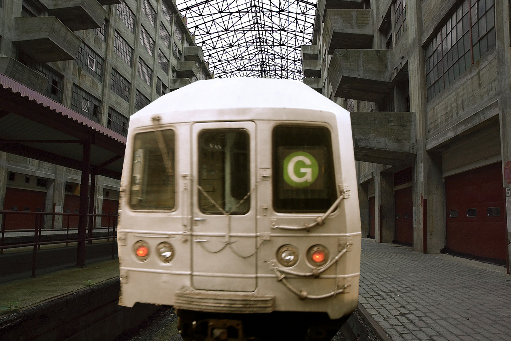
The G train arrives in the Brooklyn Army Terminal, with a little help from Pro-Zak and bitchcakesny.

You could even use the skycrane to lift commuters up to their offices. Door-to-door service!

Saturday, February 20, 2010

If you care about the G train...

Back in September, I observed that transit lines are often in competition with parallel highways. The main reason that governments have to spend so much money subsidizing transit is because they're spending more money subsidizing roads. As an example, I gave the proposed Tribororx line from Yankee Stadium to Bay Ridge, which is paralleled for much of its length by the Brooklyn-Queens Expressway and the Belt Parkway. How much ridership can we expect this line to have if the State is spending billions to upgrade the competing highway at no direct cost to drivers?

In the comments to my post, Jonathan pointed out that the G subway line also parallels the BQE in this corridor. Historically, the G has had notoriously low ridership. That has begun to change in recent years due to the booming popularity of Williamsburg and Greenpoint, but the MTA still treats it with contempt. After the V train was introduced, the MTA wanted to cut the G back to Court Square at all times. Under pressure from advocates, they agreed to run the G on nights and weekends, when the V was not running. Somehow, though, there seems to be track work on nights and weekends, nine times out of ten. I'm always surprised to actually see the G at Queens Boulevard stations.

The MTA has also run four-car trains on the G. I think they're back up to six cars, but the combination of short cars, truncated service, and infrequent service discourages people from taking the G, which in turn reduces ridership, which leads to more cuts...

The initial low ridership that seems to irk the MTA managers so much can be easily traced to the local-stop configuration of the G train and the BQE. Why would you want to sit through stops at Classon Avenue ... Bedford/Nostrand... Myrtle-Willoughby... Flushing... Broadway... if you can hop on your car and get to Queens without stopping? The alternatives through Manhattan are not much quicker; the E and the F run local, and the A only makes two stops more than the E (Spring Street and 23rd Street).

I have seen this dynamic in person multiple times. Many years ago, my girlfriend lived in Fort Greene and worked at Queens College. She would take the G to the E to the Q74 (or sometimes the A to the E, it didn't really save any time), and the total trip would take her an hour and twenty minutes. A couple years later, one of her colleagues at Queens College rented an apartment in Brooklyn Heights. I asked him if he was prepared for the long commute. Not really, he said. He had a car, and it took him twenty minutes to drive to Queens College.

Once I had a meeting in Brooklyn Heights, and from Woodside I took the 7 to the A, a little more than an hour. That meeting took longer than expected, and I had to rush back to Woodside for another meeting. With that story in mind, I hailed a cab and was home in twenty minutes.

I have a neighbor in Woodside who regularly visits his elderly aunt on Ocean Parkway. He used to spend forever on the F train, but now he takes a car service. If he owned a car himself, I'm sure he would drive.

This is the main reason for the low G train ridership: the state spent a ton of money building the BQE and the Kosciuszko Bridge, and now they're planning to spend another $1.7 billion to replace the Kosciuszko. Not just with another bridge the same width (three lanes in each direction), but with a wider one, with four northbound lanes and five southbound. These added lanes are sold as "reducing congestion," but who are they trying to kid? They'll be filled up with cars in no time.

It's true that the replacement bridge will have a unicycle lane that will make it easier for non-motorized traffic to get from Brooklyn to Queens, but the main thing it will do is make it even easier for people to not use the existing G train infrastructure, or the proposed Tribororx.

The DOT will have the second of two open houses next Wednesday in Greenpoint. They are also accepting comments by email on the project at kosciuszko@dot.state.ny.us. But the public will not be asked whether they want the new bridge to have nine lanes instead of six like the old one, or even to decrease the number of lanes to four in order to save money and encourage people to use transit. They will not be asked whether there should be tolls on the bridge to help pay the enormous cost, and to discourage overuse. No, they will be asked which of four "designs" they prefer, with the difference being mostly cosmetic. As with the Tappan Zee Bridge, the most important decision - how many lanes - was taken by the DOT without soliciting public input.

Henry Ford is quoted as saying that customers could buy the Model T "in any color, as long as it's black." In this case, you can have your bridge in any design you want, as long as it costs $1.7 billion dollars and has nine lanes to encourage lots of driving and draw riders off the G train.

Saturday, September 26, 2009

Sabotaging the Tribororx

In my last post, I observed that the main reason transit projects tend to require hefty subsidies from the government is that they are competing with heavily-subsidized roads. Because of this, it is the right and duty of transit advocates not just to promote the construction and subsidy of transit lines that they feel are worthy, but to oppose subsidies to roads that parallel those transit lines and could poach riders from them. I asked my readers to think about their favorite, favorite transit projects:
Now think about the potential riders who are driving right now. What roads parallel that project? Are they being widened? Bridges replaced? New roads or bridges being built? Do the drivers pay anything to use those roads? Do they pay to park, at one end or both? Have the tolls or parking fees kept pace with inflation? Did they once pay, but no longer?

From time to time, I will dedicate a post to this theme. I will examine a transit project and look at subsidies to the competing roads. Some of them will be defunct transit lines put out of business by roads, others will be lines that are currently struggling with low ridership, and finally there will be lines proposed or under construction, whose successes are being undermined by subsidies to parallel roads.

In the comments to my post, Alon Levy said that his favorite, favorite projects were the Second Avenue Subway (currently moving very slowly), the Tribororx circumferential line (only in proposal), and a rail tunnel from Staten Island to Manhattan (only in proposal). The Second Avenue Subway and the Staten Island rail tunnel are special cases, because of the extreme density of Manhattan and the degree to which roads there are under-subsidized relative to their use. When the Second Avenue Subway is opened, and if the Staten Island tunnel is ever built, they will fill such a deep need that they will instantly have very high ridership, enough to run an operational profit. (As Alon pointed out, whether they will ever make enough to pay back the money borrowed to build them is another story).

The Tribororx line is quite a different story. You may remember that in 1996 the Regional Plan Association proposed linking the Bay Ridge Branch, New York Connecting Railroad, Hell Gate Bridge and Port Morris Branch to run commuter rail from Yankee Stadium to the Brooklyn Army Terminal, passing through several underserved neighborhoods and connecting with twenty other transit lines along the way. As I discussed last June, it might be easier to implement the Tribororx as a series of connecting extensions of existing subway and commuter rail lines.

Working for the RPA, in 2007 Michael Frumin modeled potential ridership on the line and estimated that it would draw 76,000 riders a day, including 32,000 new riders from "other modes of transportation." This calculation is based on the fact that many trips would require a smaller number of transfers, which is more attractive to travelers. Frumin hoped that this prediction would generate interest in the line, although sadly that does not seem to have occurred.

Unlike Alon's other two choices, the Tribororx route is paralleled by one major highway in particular: the Brooklyn-Queens Expressway. It is also paralleled for part of its length by the Belt Parkway. Frumin assumes that these highways would continue to be just as unappealing as they are now - to everyone, including drivers. Taking the BQE from Brooklyn to Queens during rush hour is guaranteed frustration, especially on the Kosciuszko Bridge across the Newtown Creek. The Belt is also not a happy place to be.

As I've discussed in the past, the Shore Parkway is currently being reconstructed. We could save money by bringing the "parkway" back to true parkway standards, but that's on nobody's radar right now. The State DOT is also planning to reconstruct the BQE in Cobble Hill, at a cost of more millions of dollars. Finally, over the next few years the State DOT will spend $700 million to replace the Kosciuszko Bridge, expanding its capacity from six narrow lanes to nine wide ones and reducing the height of the bridge so that drivers can go faster.

So, if we're spending serious millions to make it easier for people to use the parallel roads, what do you think that will do to the ridership numbers for the Tribororx line(s)?

Wednesday, June 11, 2008

TriboroRX: Is the capacity there?

In discussing the TriboroRX proposal, I have serious concerns about the capacity of the right-of-way to handle this amount of service. Right now the Bay Ridge Branch and the New York Connecting Railroad are single-track freight lines in many places. Of course the proposal is to increase it to two tracks and possibly four where there's room. In fact the Bay Ridge Branch and the NYCR were originally four tracks for part of their length and can fit three, if not four, from the Brighton Line (Q train) to Fresh Pond Yard, and possibly even six for part of the right-of-way west of the Culver Line (F train). But the rest of the line, from the Culver Line to the Brighton Line, and from Fresh Pond Yard to the junction with the Amtrak line to Penn Station in Woodside, is two tracks, and even if the right-of-way could fit another track here or there, it would be expensive to expand the bridges and tunnels.

The problem is that these lines are still used for freight trains, and unless they're expanded to three tracks for the entire length, they will need to share the tracks. It's not unprecedented for transit and freight service to use the same tracks: New Jersey Transit's River Line between Camden and Trenton shares tracks with Conrail freight. However, New Jersey Transit has an agreement with Conrail that the passenger trains will only run from 6AM to 10PM, except Saturday nights. That might work in South Jersey, but it would be difficult in New York City, even in Maspeth.

But let's suppose that it was worth running passenger service just for the daytime and evening use. The River Line is a secondary freight route, and only runs a few trains a night, and the Bay Ridge Branch is even more lightly used. Good, right? Wrong.

There is a proposal for a Cross-Harbor Rail Freight Tunnel to connect the Bay Ridge Branch with the Greenville Yard in Jersey City. Currently, rail freight going from New Jersey to or through New York City needs to either be floated across the river on barges, or hauled over 150 miles north to the bridge at Selkirk and 150 miles back south. In practice, it's cheaper and easier to transfer the freight to trucks and drive it over the bridges. Of course that wears down and clogs up the city's bridges, highways and streets, pollutes the air and increases traffic carnage, hence the need for the tunnel.

According to the Draft Environmental Impact Study for the tunnel, insted of eight train trips a day, there would be 24-64 freight train trips using the Bay Ridge Branch per day (page 8-69 of this PDF), depending on whether one or two tunnels were built. The DEIS is very unclear on the anticipated number of train trips on the Hell Gate Bridge, but the total number anticipated for LIRR destinations (i.e. all other destinations) is 13-15 per day. It sounds like that means we'd see 11-49 trains going over the Hell Gate Bridge, but I can't figure out whether the prediction is closer to 11 or to 49. I'm going to assume the most extreme scenario of 49 trains a day; it's still less than four an hour.

The TriboroRX proposal also doesn't take into account the plans to run Metro-North trains from New Haven to Penn Station via the Hell Gate Bridge. This would run five trains an hour in each direction during peak hours, a substantial addition to Amtrak's current ten trains per day.

Adding it all up, it looks like the following by the hour:

SegmentMax tracksCurrent freightCross-Harbor freightAmtrakCommuter railtotal
Hell Gate4<1421014
NY CR2<14004
Bay Ridge FP to Brighton Line4<15005
Bay Ridge Brighton Line to McDonald2<15005
Bay Ridge McDonald to BAT8<15005

Here's the bottom line:
  • Hell Gate: Amtrak, Metro-North and freight trains could fit two tracks if the freight trains are all run on off-peak hours, leaving two tracks for TriboroRX service. Some Metro-North trains could potentially share tracks with the TriboroRX trains to make room for more freight or Amtrak trains.

  • NY Connecting Railroad: Requires widening, time-sharing or commuter rail.

  • Bay Ridge Branch from Fresh Pond to Brighton Line: Freight trains can run in one or two tracks, leaving two tracks for passenger service.

  • Bay Ridge Branch from Brighton Line to McDonald Avenue: Requires widening, time-sharing or commuter rail.

  • Bay Ridge Branch from McDonald Avenue to the Brooklyn Army Terminal: Wide enough for anything.

Saturday, June 7, 2008

Connecting Brooklyn and Queens: TriboroRX and the Winfield Spur


The map above is a detail of map of the 1929 proposal for the Independent Subway Second System. I'm posting it to show you the Winfield Spur. This planned line would have diverged from the Queens Boulevard Line just east of the Roosevelt Avenue station in Jackson Heights, serving Winfield (once its own town within Queens County, now a suburb of Woodside), Maspeth and Ridgewood before merging with the proposed Myrtle Avenue Subway to run along Central Avenue in Glendale and finally run alongside the old Long Island Railroad Rockaway Branch to the Rockaways, the route that the A train now takes - with a new branch through Southeastern Queens.

This was never built because, well, you know what happened in October of 1929. However, the First System was built to hook into it, and at the east end of the Roosevelt Avenue station is an upper level platform with two tracks that turn off into a wall.

Bobby at nycsubway.org writes:

This was designed to provide through service to the Rockaways from midtown, and also to serve the neighborhoods of Maspeth and Ridgewood. It would have been a two track line arising from the Roosevelt Avenue station (the never-used upper level station, but also would have track connections to the main line), and curving southeasterly between 78th and 79th Sts. to Queens Blvd., then along the LIRR ROW into Garfield Avenue to 65th Place, then along 65th Place to Fresh Pond Road, and then along Fresh Pond Rd and Cypress Hills Avenue to a connection with the Central Avenue line outlined above. The line would be 2 tracks, and would be subway to 45th Avenue, then elevated to Fresh Pond Road, then subway again to Central Avenue.


If this had happened, Winfield, Maspeth and Glendale would have one-seat rides to Manhattan, and would probably look a lot different than they do today. As it is now, they're dependent on cars and buses to the train to get to Manhattan. Digging a subway in Jackson Heights and Ridgewood would probably be a lot cheaper than the Second Avenue Subway, but it would be difficult to justify the expense.

However, the Regional Plan Association has endorsed the idea of using the New York Connecting Railroad for subway-type service, and in this area they practically duplicate each other. With my mad graphic skillz I have drawn the approximate route of the NYCRR on the 1929 map.


In fact, as Michael Frumin notes, it passes close enough to the western end of the Roosevelt Avenue station that a transfer could be made fairly easily.

The TriboroRX plan as envisioned by Frumin and his bosses at the RPA could serve Winfield, Maspeth and Ridgewood, although not as centrally as the planned subway line. It would also not give them a one-seat ride to Manhattan, but rather require them to change at Jackson Heights, Middle Village or East New York.

As I've discussed in previous posts, though, it may make more sense to use sections of the TriboroRX right-of-way to run Manhattan-bound subways. In this case, we could dig the tunnel from Jackson Heights to the NYCRR and run one of the Queens Boulevard trains (like the R or the V) along this section of track to East New York, and perhaps further. In addition to a one-seat ride to Manhattan, this would allow residents of Western Queens to travel to East New York and transfer to the A, C, J, L, M, Z or 3 trains to reach other parts of Brooklyn.

We could also allow transfers to the M at Metropolitan, but then turn east at Fresh Pond Yard and run the line along the old Montauk Branch right-of-way through Glendale, Forest Park and Richmond Hill, connecting to the Rockaway Branch as in the 1929 plan or continuing on to Jamaica and potentially turning around in the Archer Avenue tunnel. Either way, we'd bring good transit to some previously underserved neighborhoods.

Sunday, June 1, 2008

TriboroRX: Brooklyn Army Terminal to East New York

In a recent post, I discussed the Regional Plan Association's TriboroRX proposal, and Michael Frumin's research on potential usage. I mentioned that it was not necessarily the best solution to run a single train along the entire route, that it might be better to chop the right-of-way up and use it to extend other lines. In particular, I highlighted the 1969 proposal to re-route the L train to Brooklyn College. I can definitely see value in that proposal: from Wilson Avenue to New Lots Avenue, the L stations are all directly over the cut of the Bay Ridge Branch; the East 105th Street station is three blocks south of the cut, and the Rockaway Parkway terminal is four blocks south. The inconvenience of moving these two stations would be more than compensated by the improved connections.

You could conceivably extend the other trains to the west of Brooklyn College; the 2 and 5 trains come to mind. The problem is that those trains already travel much longer distances than the L, taking over an hour to get all the way from the northern edge of the Bronx to Brooklyn College. The situation is similar with the B, the Q, the F, the M and the D trains, but each would require splitting one of the routes as well as extending it - or else abandoning B service to Brighton Beach or M service to Bensonhurst.

The L currently takes 40 minutes to go from Eighth Avenue to Rockaway Parkway. It would probably take another ten minutes to get to Brooklyn College, and then another 10-15 to New Utrecht Avenue. Another possibility would be to extend the G train, which takes only 35 minutes to get from Court Square to Church Avenue. It would require tunneling new tracks under the elevated F viaduct from Church Avenue to the right-of-way.

From New Utrecht Avenue west to Fourth Avenue, the right-of-way runs right next to the N train (with two unused express trackways in the N right-of-way). It does not make sense to duplicate the N service, unless the frequencies are too low. West of Fourth Avenue, there are two reasons I can think of to run a train to the Brooklyn Army Terminal: jobs and the ferry. If this is desired, then extending the G would probably be the best choice. The L would be extended to MacDonald Avenue, and the G to the Brooklyn Army Terminal.

These two extensions combined would do wonders to connect the southern parts of Brooklyn with each other, and with Manhattan. It would go a long way towards making Brooklyn College more accessible to people from all over the borough, and bring new service to the areas of East Flatbush, Flatlands and Brownsville that haven't had rapid transit in many years.

Monday, May 26, 2008

Connecting Brooklyn and Queens: Just what the doctor ordered?

There are many subway and commuter rail lines that cross from one borough to another, but some crossings are particularly underserved. One that's often mentioned is between Brooklyn and Queens.

There are in fact five subway lines that connect Brooklyn and Queens directly: the A/C Fulton Street Subway/Liberty Avenue El, the G Crosstown Subway, the M Myrtle/Ridgewood El, and the J/Z Fulton Street/Jamaica Avenue El. The LIRR Atlantic Branch also goes from Downtown Brooklyn to Jamaica. Connections from Jamaica and Ozone Park to Downtown Brooklyn are good, and connections from Greenpoint and the other G train neighborhoods to Long Island City are good. Connections from northern and western Queens to southern Brooklyn are not so good.

What we don't have right now is any concrete information about what neighborhood pairs people want to travel between in Brooklyn and Queens, so we don't know exactly where the greatest need is, or the greatest potential ridership. So we don't know which corridor to work with.

There is some information available, the census journey-to-work data. Working for the Regional Plan Association, Michael Frumin used this data to model potential ridership for one particular line: the Triboro RX proposal to run subway-frequency service along the NY Central Port Morris Branch, Hell Gate Bridge, NY Connecting Railroad and LIRR Bay Ridge Branch, from Yankee Stadium all the way to the Brooklyn Army Terminal. Frumin wrote, "At the end of the day, we can comfortably say that at least 76,000 New Yorkers (including 32,000 diverting from other modes of transportation) would use the Triboro RX to get to and from their jobs every day." Obviously, there are not that many people who live in Bay Ridge and work in Concourse Village or vice versa; most of the trips that Frumin projected would be less than a third of that length.

It'd be nice to have some easy interface to the journey-to-work data to be able to tell, for example, where the best place to build a new Brooklyn-to-Queens connection would be. It would also be helpful for estimating the effect of only building part of the "Triboro RX" at a time.

In fact, just because there's an unbroken set of tracks running from St. Mary's Park to Owl Head Park doesn't mean that you need to run a single train line the whole way. It might be better to use the line for extensions or branches to several different lines instead.

I'll give one example, which was actually considered by the MTA back in the 1960s: to extend the L train west to Brooklyn College. This and other uses of the Bay Ridge Branch were considered in a long and multi-branching SubChat thread last year. Someone was kind enough to post scans of a map that was released by the MTA and the city in 1969, and another that was printed in the New York Times in 1971. (The rest of the scans are worth a look as well). More potential uses later.